Written by: Basant El-Farmawy
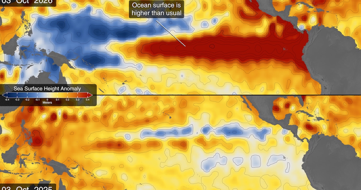
NASA satellites are tracking developments in the El Niño climate phenomenon in the tropical Pacific Ocean, which experts indicate could be the most severe since 1950, using advanced technologies to measure sea level, temperatures, and water color. Estimates from specialized climate agencies indicate a high probability of the continuation of this natural phenomenon, which typically appears every few years, directly affecting global wind movement, heat distribution in the oceans, and rainfall patterns in various regions around the world, leaving a clear impact on the agricultural sectors and coastal communities.
Monitoring Kelvin waves and rising ocean temperatures
Since the beginning of the year, satellites have observed a mass of warm water known as Kelvin waves, which are slow-moving pulses flowing across the Pacific Ocean from west to east, transporting massive amounts of heat. This thermal flow raises air temperatures and leads to changes in atmospheric pressure that may weaken or reverse the direction of regular trade winds. As a result of these sequential processes, sea surface temperatures in the eastern part of the Pacific Ocean have risen by about 1.7 degrees Celsius above the long-term average, recording notable rises in coastal water levels compared to other regions.
Changes in ocean color and the decline of phytoplankton
In addition to monitoring the rise in temperatures, data from satellites dedicated to studying ecosystems and oceans have helped detect subtle changes in water color associated with the presence of microorganisms. The weakening of deep upwelling currents that carry nutrients leads to a decline in phytoplankton quantities in tropical regions, changing the water color from the usual green to clearer shades of blue. These advanced technologies allow scientists to track the response of marine ecosystems to complex climate changes and understand their direct and indirect impacts on marine life around the world.